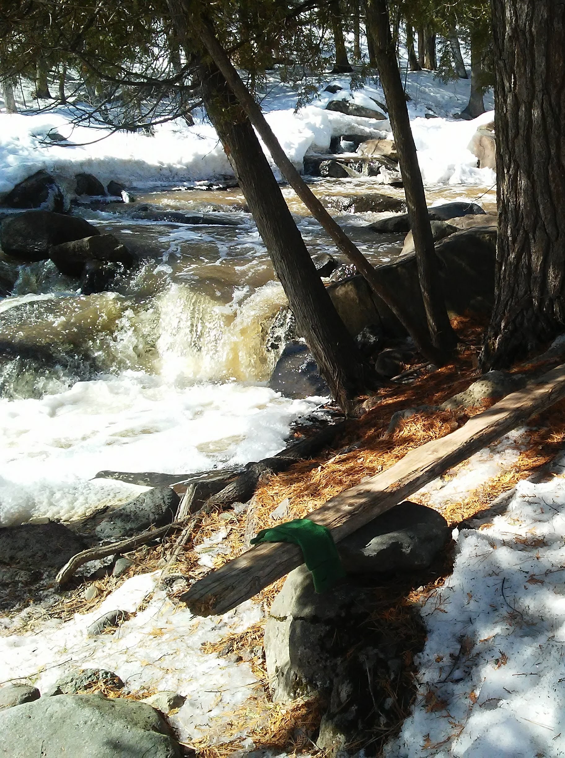
The Superior Hiking Trail Association works together with the Duluth City Parks and the North Country Trail Association to maintain over 300 miles of footpath along the North Shore of Lake Superior in Minnesota. I recently became a member of the SHTA because I want to do my part to make sure that the trail will be there for years to come. There was an event at the Lake Superior Zoo to educate volunteers about the organization. I was glad I went so that I have a better idea of who they are, what they do, and what needs to be done. It was fun that the meeting was in the Pavilion at the zoo. Kingsbury Creek runs through the property and there are stone bridges creating lovely landscapes. After the meeting I walked around looking at bridges, rocks, water, and animals. It was a perfect morning.
They had some trail experts give them feedback about the current structure of the trail. One of the observations was that much of the trail is made simply by people walking on it. It reminded me about the book I am reading, “We Make the Road by Walking” by Brian McLaren. Same idea. Whether you are talking about a physical path or a metaphorical life path, the more you walk along the same route, the more defined the trail and the easier it is for others to follow. Hmmm. There is another idea for a future post. I have a long list now in the “drafts” section of this blog. Feel free to mention in the comments any topics I said I would revisit.
They also said that their new guiding phrase regarding the trail is “Keep water off and people on”. I did not know until recently that if you happen upon a patch of mud on the trail, you are supposed to walk right through it, not around it. Walking around it makes it wider and causes damage to the trail. Maybe I should not put away my snow boots yet. They are tall and waterproof, they can be mud boots. I am glad that efforts are underway to prevent the mud from forming in the first place.
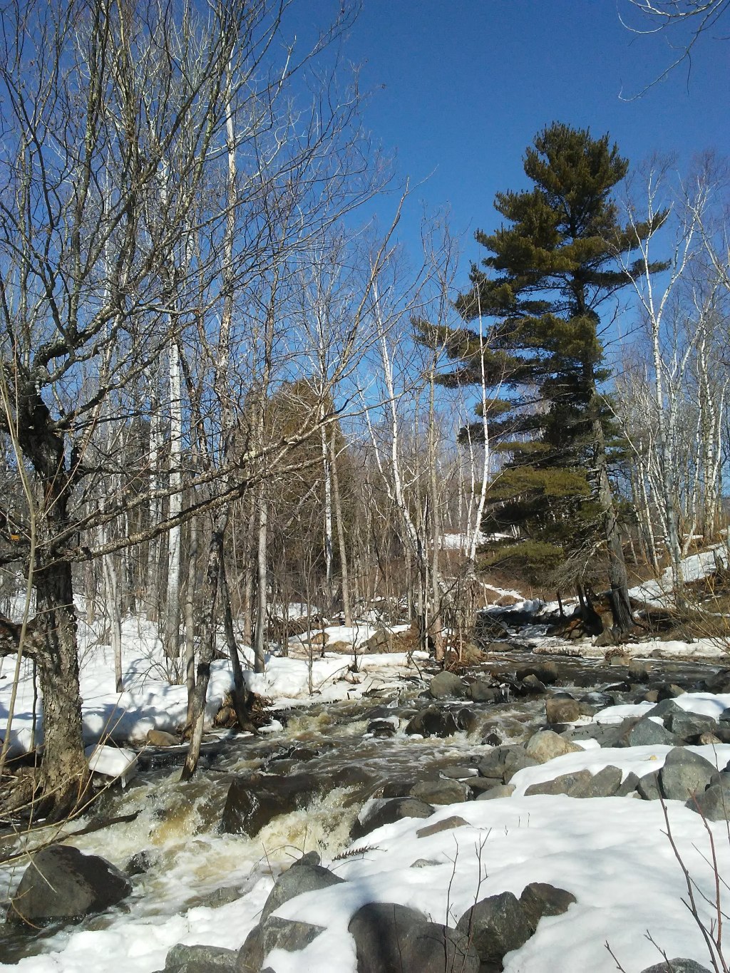
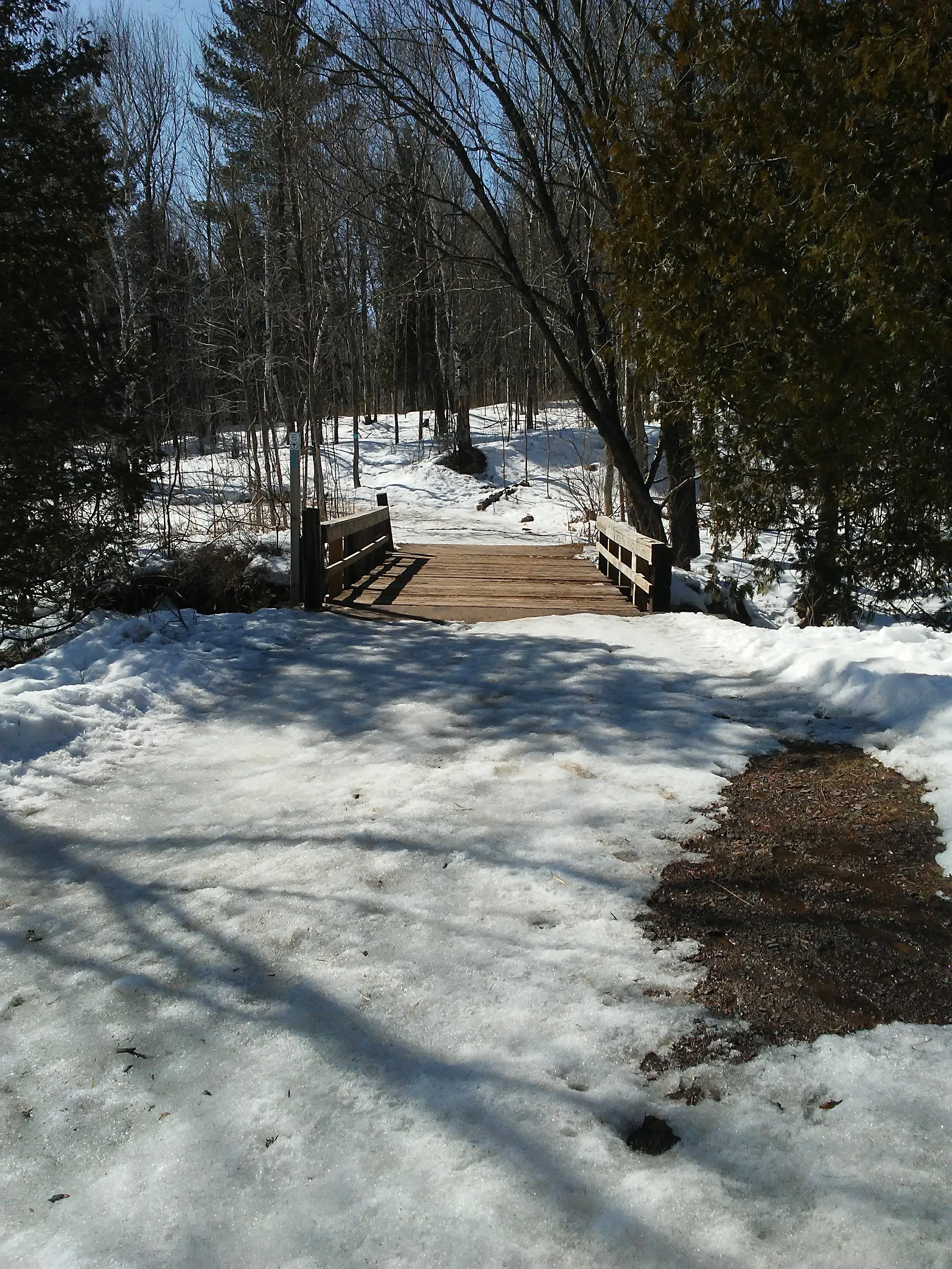
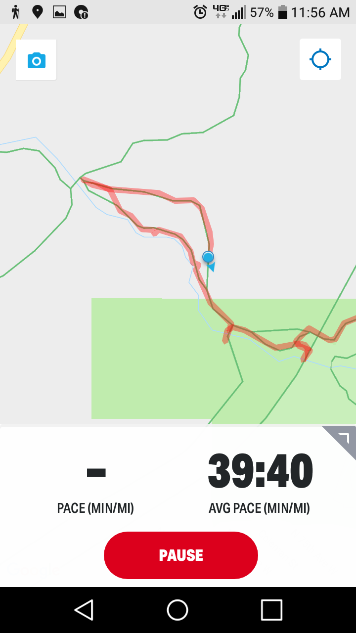
One of the perks of membership in SHTA is a set of updated maps. It would have been good for me to check the section near the zoo before I set off on a hike from there. I used my phone and Google maps. I kept my blue dot on the line that said Superior Hiking Trail, but most of the time it looked like this:
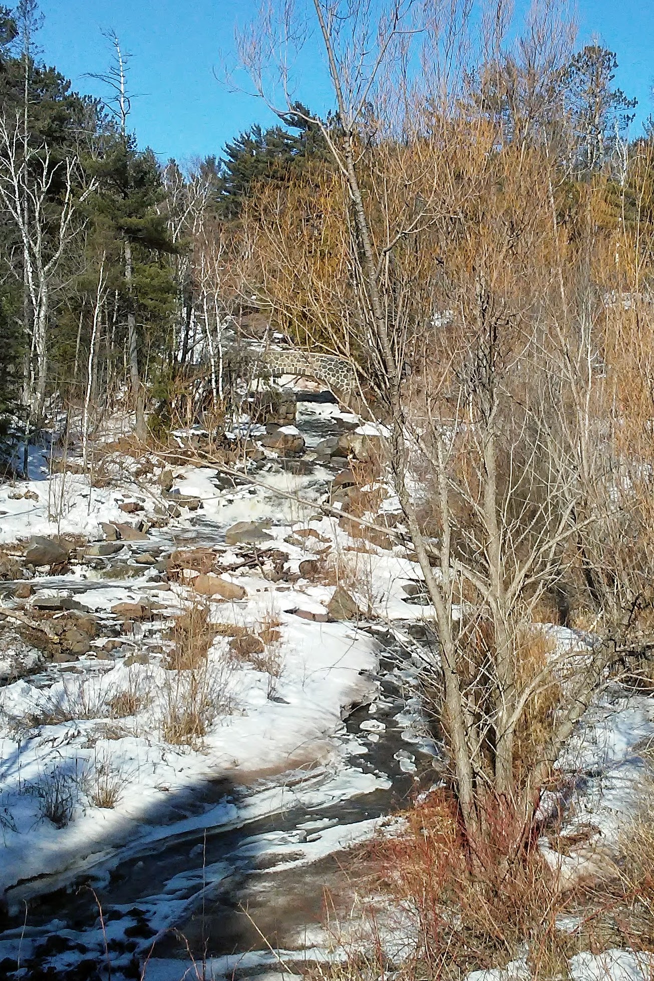
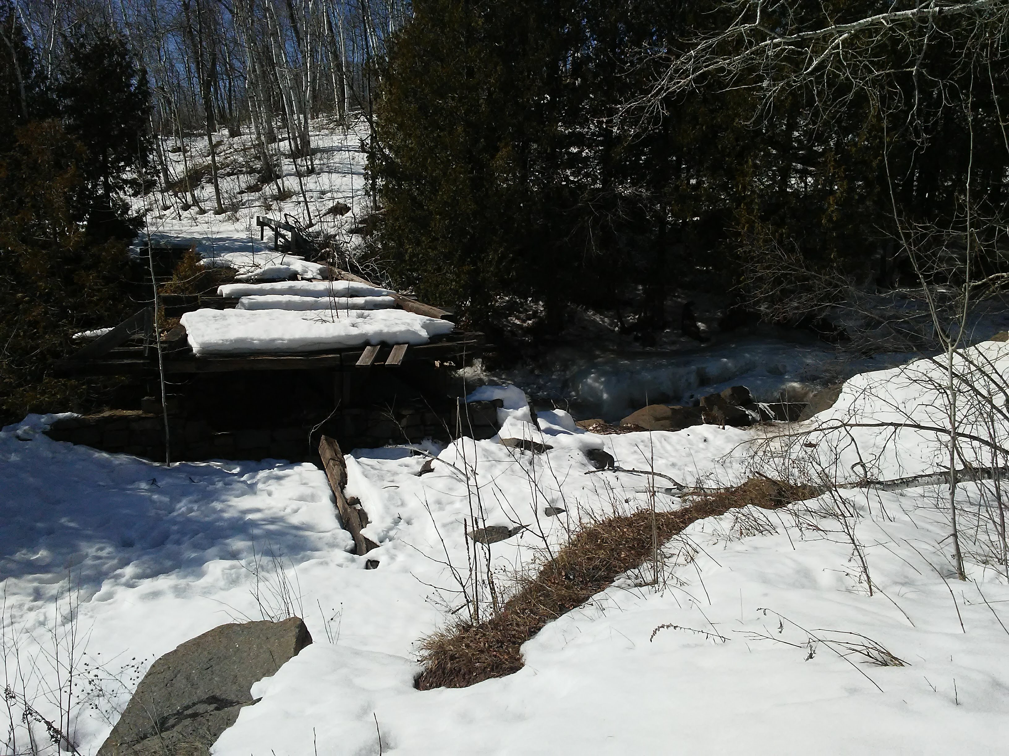
It did not take long for me to realize that Google maps was outdated regarding this section of trail. I decided to keep going to the next intersection and then take the wider trail back to the parking lot. My reward for going this way was a bench next to a cedar tree and a beautiful spot to sketch the river. This was probably put there by SHTA volunteers years ago. Thank you!
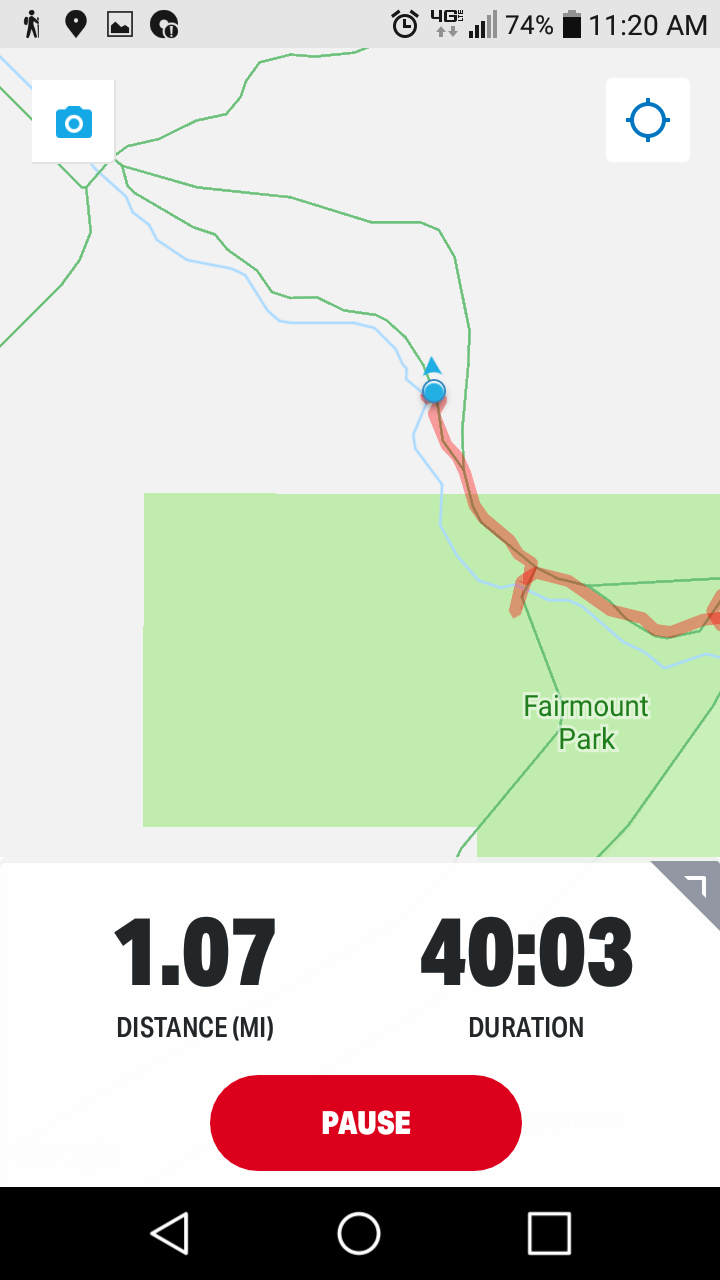
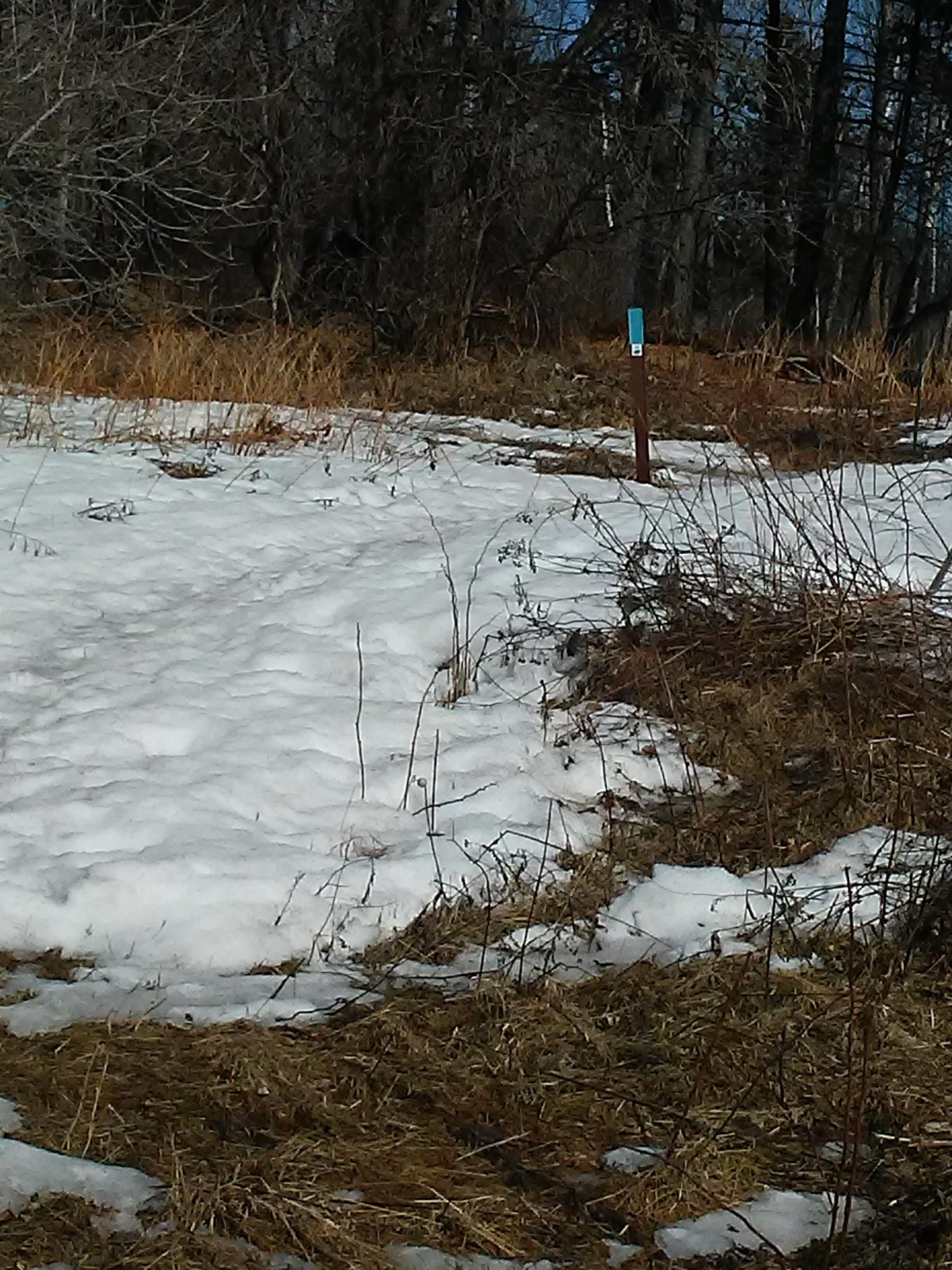
I thought I would be back on the current trail when I got to the intersection. It looked like this:
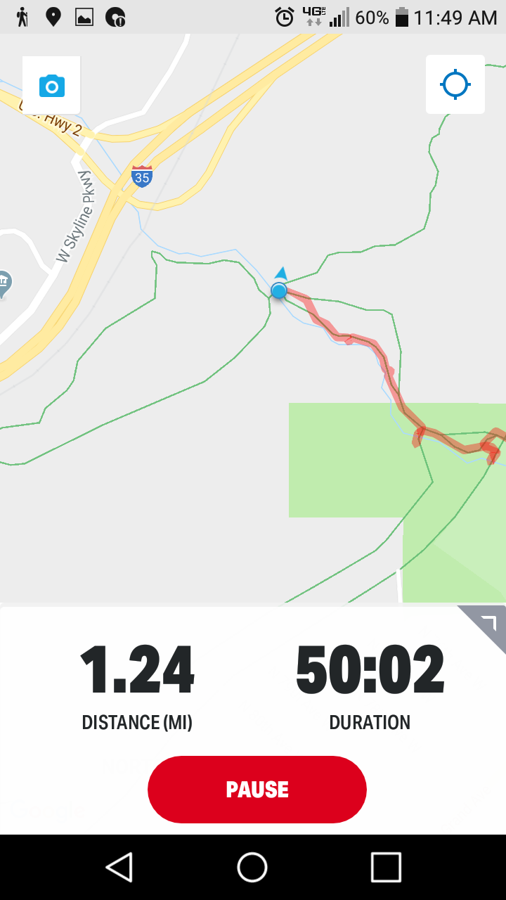
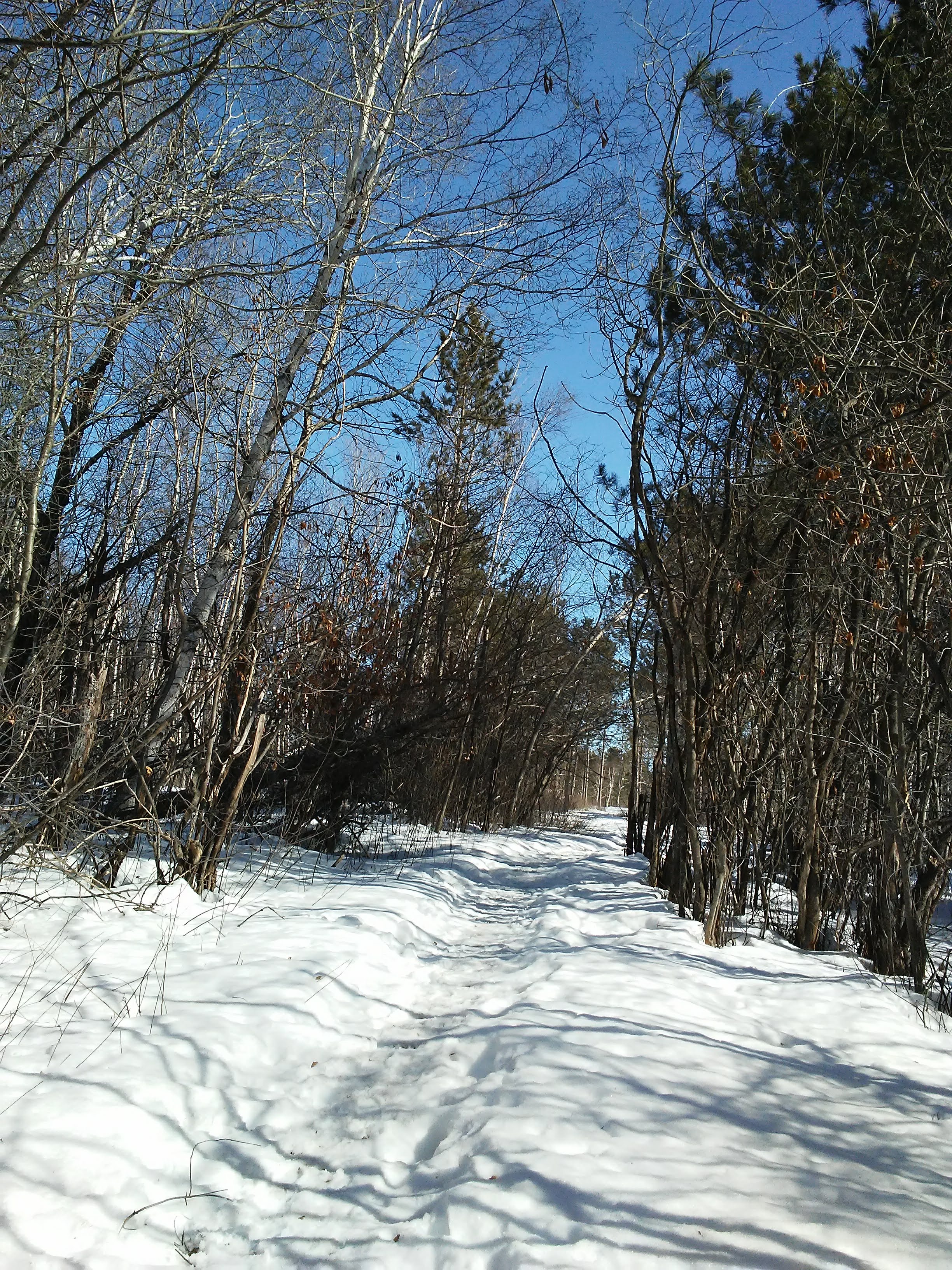
On the way back I noticed the very clearly marked intersection of the Superior Hiking Trail and Old Thompson Hill Road. On the way up I guess I either did not believe it, or I just wanted to follow the map on my phone and see what happened. It was a fun adventure. I submitted an update to Google maps, we will see what happens.
Each time it is time for me to hit the “publish” button, I decide which of the drafts is the best one so far. I have not had a post about a specific section of trail lately, and this information may be helpful to others. Let me know if this was helpful to you!

Leave a comment