
Many SOBO (southbound) thru-hikers end their hike at the Martin Road Trailhead, but this is where we started our southbound day hike. We parked on the road because the parking lot is temporarily closed. Check trail conditions at shta.org if you plan to park there.
Why end a thru-hike here? I am not sure. Our hike had great scenery, woods, and I could hear a river nearby. It was a joy to experience. A short section was in a residential neighborhood, perhaps that is what indicates the end of the hike for some. I can understand that. 250 miles of trees, rocks, and water followed by houses and barking dogs might kill their peaceful backcountry vibe.
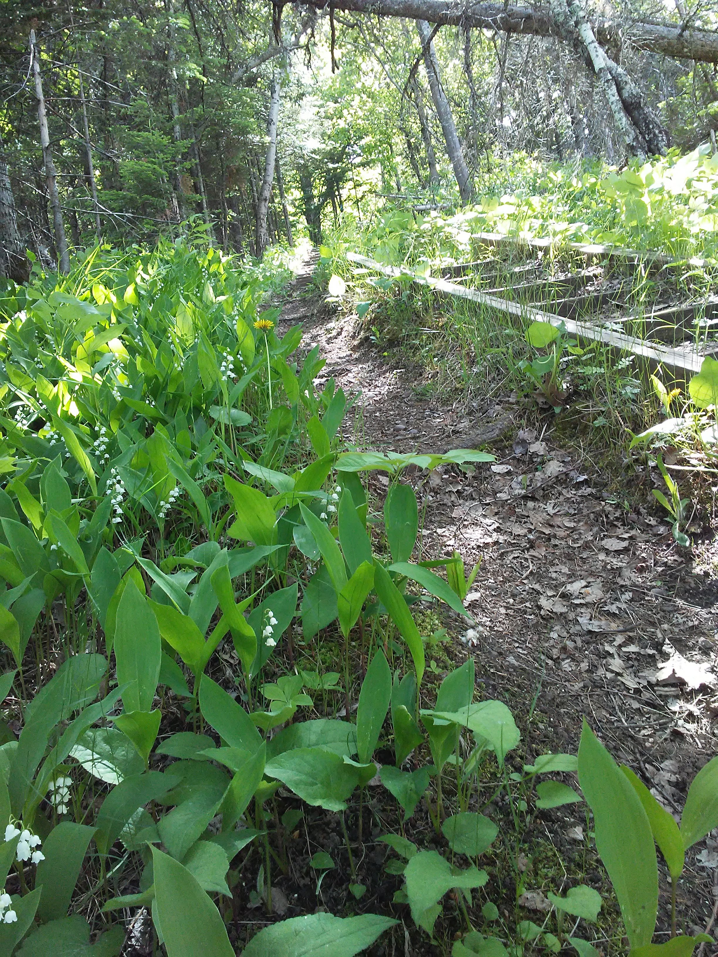
We had minor uncertainty of which way to go in a couple places but trail signs, our map, and gps on our phones was enough to keep us on the right path.
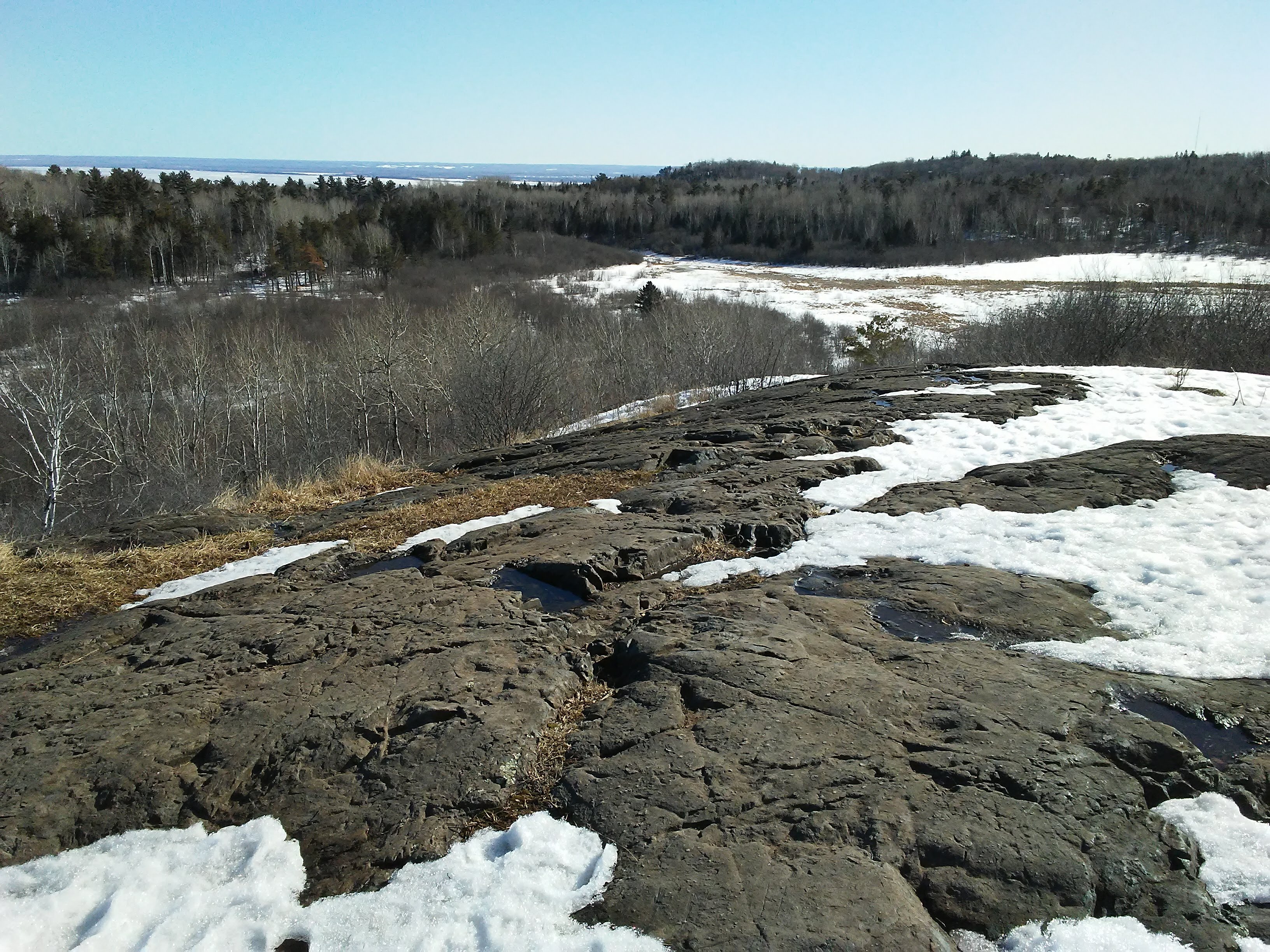
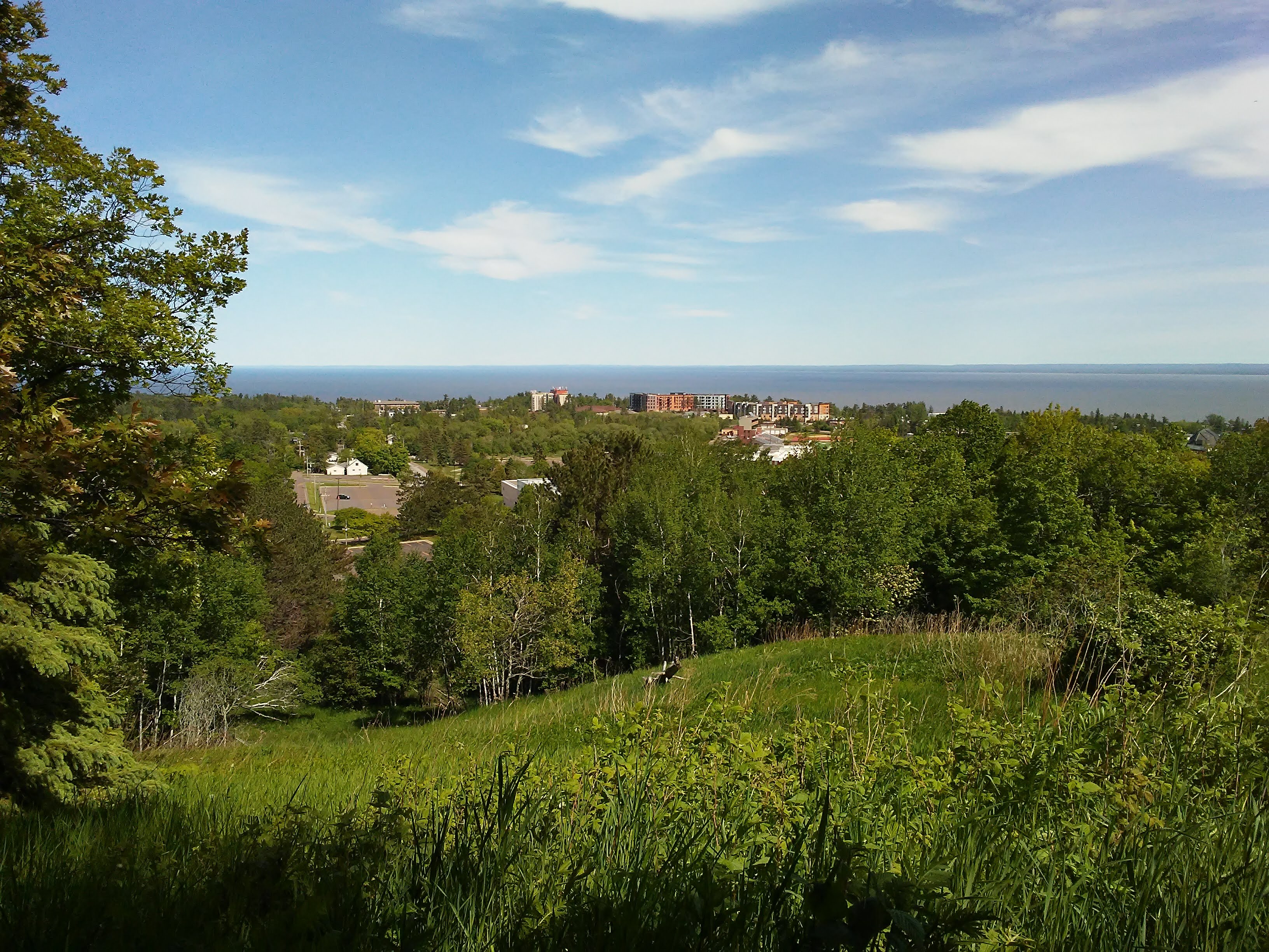
3.1 miles (5 km) into our hike we arrived at Hartley Nature Area. Once a farm that claimed to popularize celery in the early 20th century, it is now a great place to walk, picnic, canoe, fish, take classes, or climb to a great view of Lake Superior. I was here in the early spring and climbed to Rock Knob, the highest point on this property.

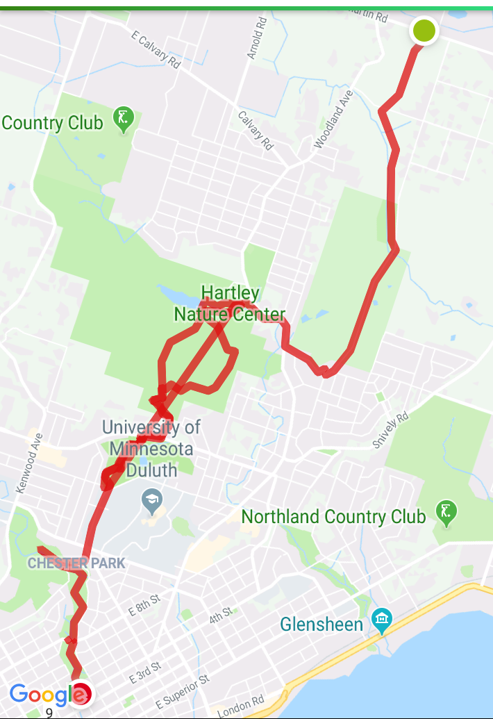
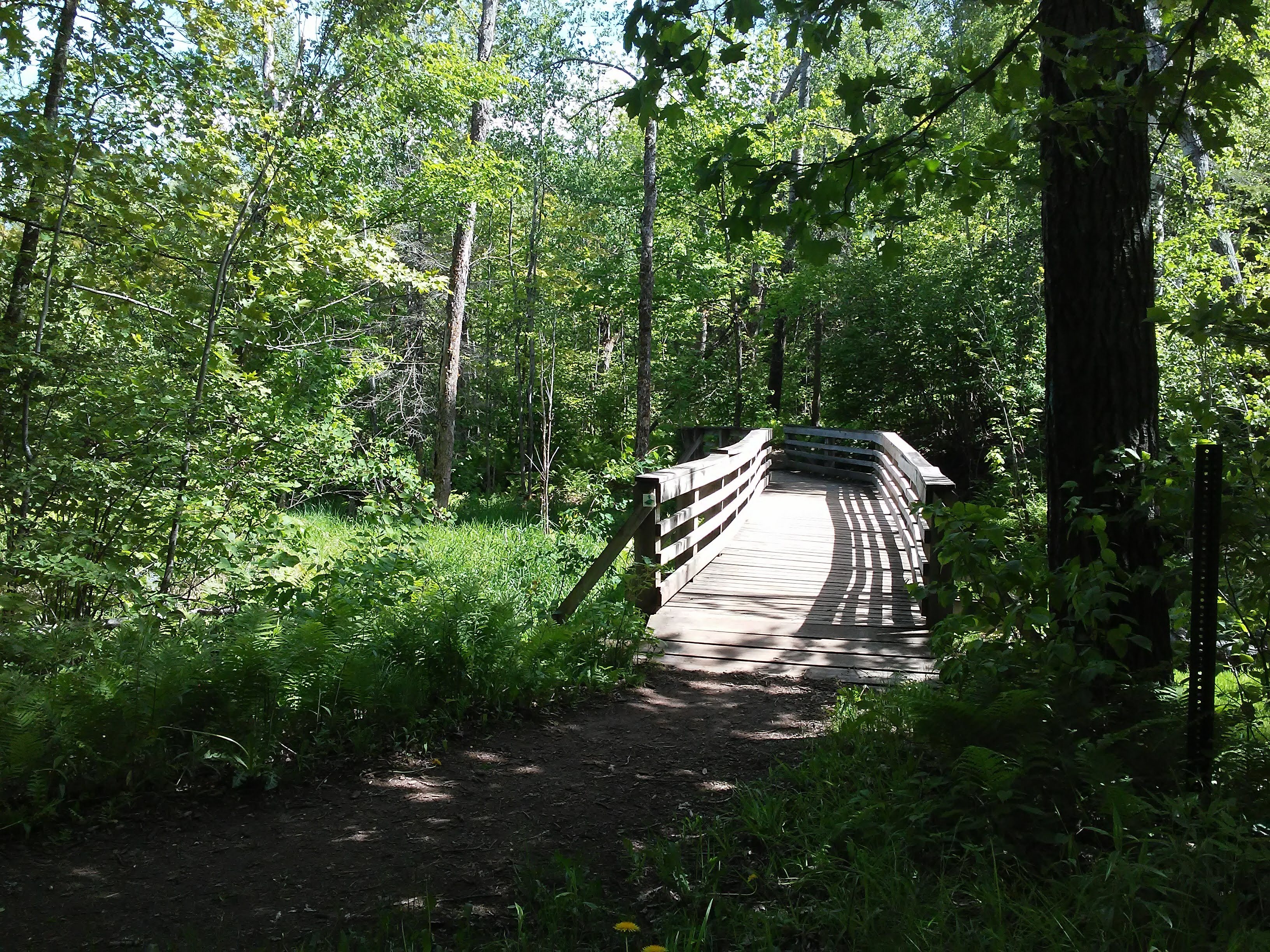
This is where we left one of the cars because we did not know how much time we would have to hike. Our plan was to leapfrog the cars until time ran out. We made it more complicated than necessary and ended up walking the second section backward from Bagley Nature Area back to Hartley. This was an exceptionally beautiful section with a scenic overlook, lots of steps, and a few bridges over streams. At Hartley the second time, my friend was out of time and left the hike. I headed back to Bagley. Luckily there is a shortcut. A wide flat trail cut through the hills and was my shortcut back to my car.
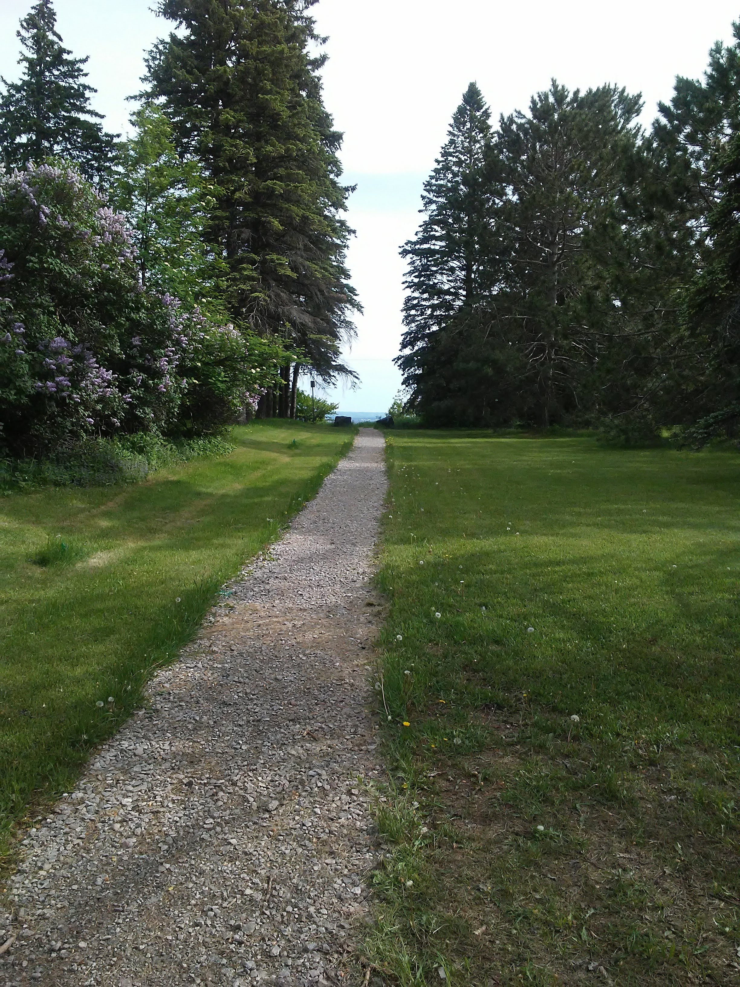
The trail signs were easy to follow from the UMD parking lots to Chester Park. I remember many years ago I participated in the Split Rock Art Program and walked many times from campus to Chester Park to draw the waterfalls. Most of that walk was through the residential neighborhood; up the hill, down the hill, up the hill. What a relief to see this path that cuts through directly to an entrance to Chester Park! Was it always there and I just missed it?
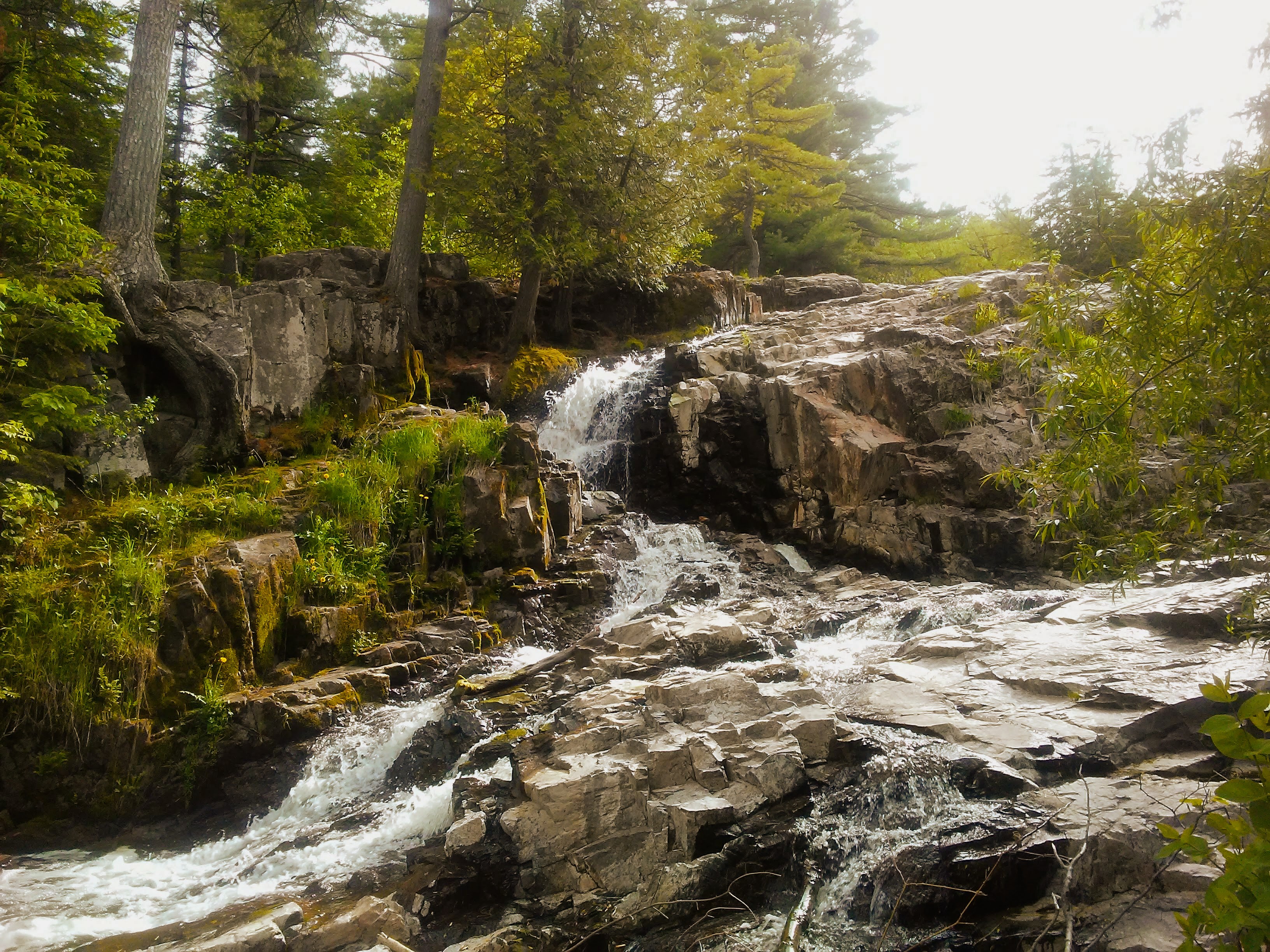
Chester Park has one of my favorite waterfalls. A pastel drawing that I created here in about the year 2000 is still a happy memory for me. I was in the zone. The picture that was showing up on the paper was close to what I wanted it to be and the unexpected bits were making it even better. That does not happen very often. It is that experience that I am chasing as I continue to paint and draw outside.
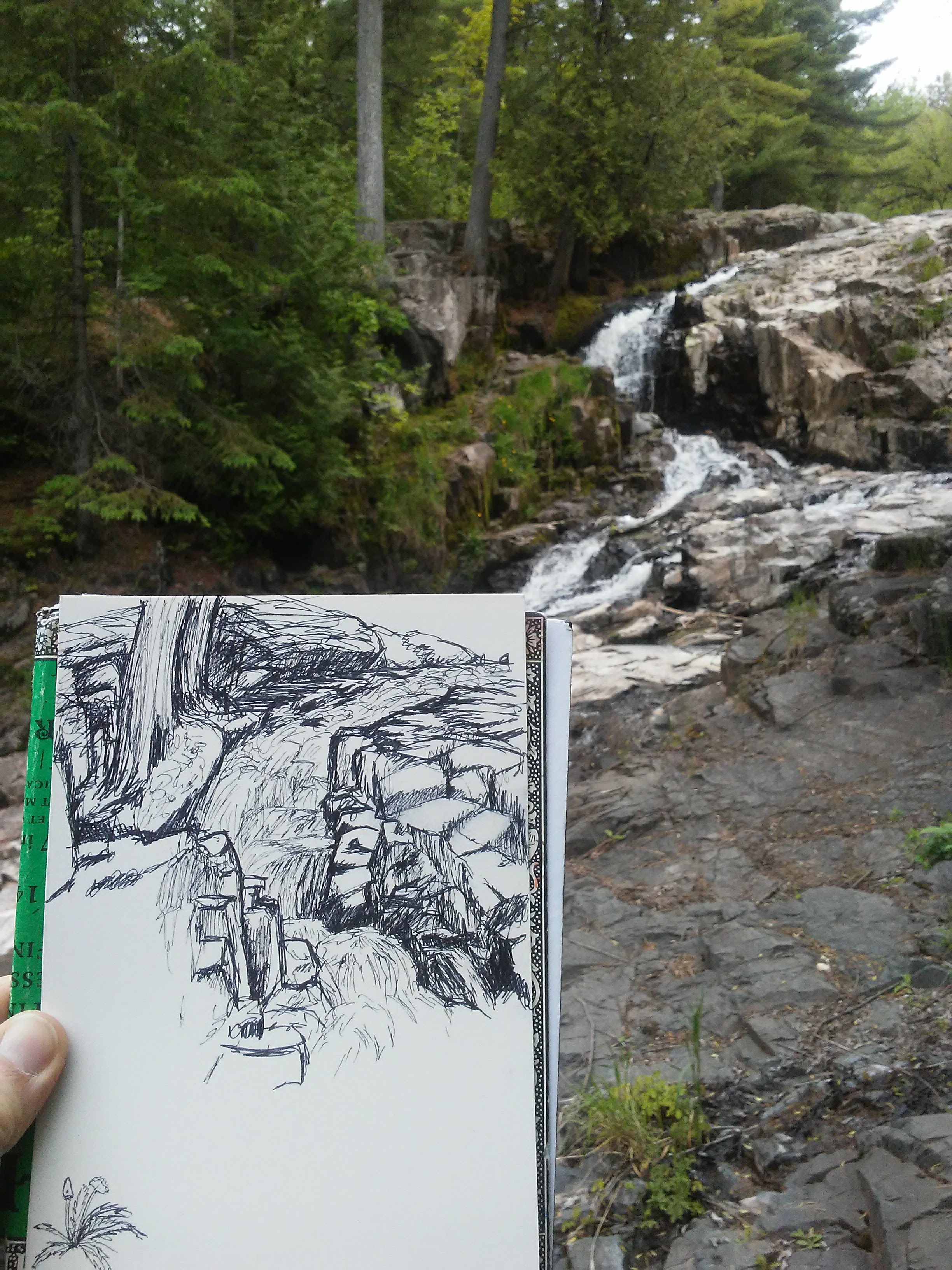
As I drew this waterfall my friend called to see if I was ready to stop for the day. We agreed to meet at a restaurant that is right on the trail: Burrito Union. I followed the trail downstream until it came out of the woods practically at Burrito Union’s front door. Looking at my hiking app, I saw that I was at 9.8 miles (almost 16 km). I turned around and walked back into the woods until I got to 10 miles. Nice round number. Do you ever decide to go just a bit further because of something like that? Feel free to share your thoughts in the comments!


Leave a comment